

Topographic measurement
Our company is highly specialized in providing the technical assistance necessary for the various phases of the design and construction of any work (Roads, Railways, Tunnels, Pipelines, Power Lines, etc.), from the supply of aerial photogrammetric cartography for the preliminary design and definitive to the topographic surveys for the executive and constructive design, and to the topographical assistance on site in the various construction phases.
Topographic measurement

- Plano-altimetric surveys with GPS and / or Total Station technology;
- Surveys with Laser Scanner of buildings, monuments, bridges, viaducts, tunnels, etc.
- Topographic assistance on site for surveys, layouts, topographical checks;
- Traced in the tunnel during the various stages of their construction;
Support to the construction site technical office, cad operators and work accounting; - Design checks of the quantities of earth movements;
As built reliefs.
Surveys with Drones

- Aerial photogrammetric topographic survey with processing of georeferenced orthophotos, point cloud, 3D models, contour lines, DTM-DSM-DEM;
- Surveys and monitoring videos in areas at risk of hydrogeological dissent;
- Calculation of volumes of excavations and mining activities;
- Construction site monitoring;
- Inspections of structures, bridges, roofs, facades;
- Architectural reliefs.
Monitoring, Precision Geodetic Checks

- High precision geometric leveling;
- Monitoring of facilities;
- Landslide monitoring.
Bathymetric Reliefs
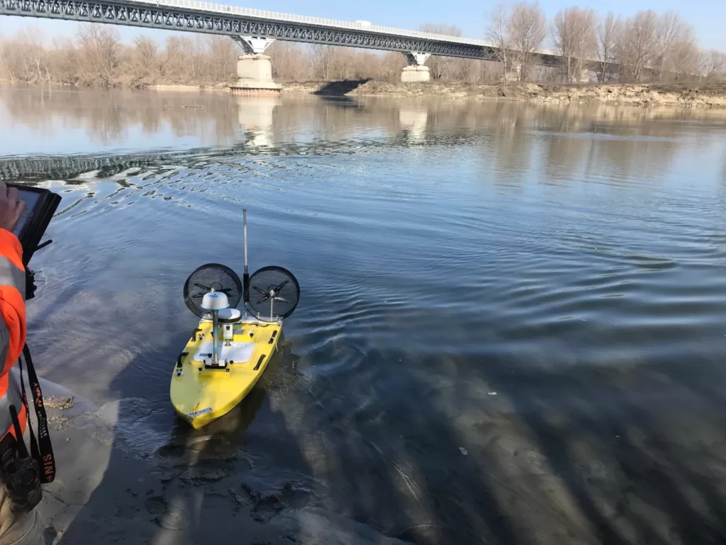
- Bathymetric surveys with singlebeam, multibeam echo sounder, of lake, river and marine bottoms (also with automatic boats);
- From the data obtained from the surveys we provide quoted plans, isobaths, representation of the seabed with false color scale, 3D images, profiles and sections for volume calculations, etc.
Aerofotogrammetric surveys
- Acquisition and processing of aerial images
also with Lidar Technology. - From the data obtained we provide: digital numerical maps, orthophotos, DTM-DEM, thematic maps, database creation and GIS services.
Indagini del Sottosuolo

- Mapping of subservices;
- Video Inspections;
- Investigations with Georadar.